


The Höllentalklamm [2]: Across the joch and through the klamm
Last week we shared the first part of our day trip to Garmisch. Our destination: the Höllentalklamm (gorge).
The map is a little chaotic, but at this point we had finally made it from bus, to train, to another train, to a gondola, to another gondola... and arrived at the Osterfelderkopf panorama viewing area (end of the upper yellow arrow).
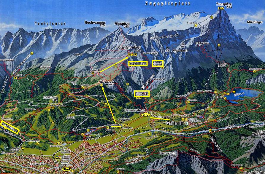
Now we really start walking. We're going to hike left-to-right across the Hupfleitenjoch ("joch" = pass), the name outlined in yellow just under the Osterfelderkopf. Then we reach the last yelow box on the right, the Höllentalangerhütte ("hütte" = hut -- it's the upper border of the gorge). We'll walk down through the Höllentalklamm (labeled on map) to the bottom yellow box (Höllentaleingangshütte, the gorge's lower border).
From here, we'll descend the rest of the way to the town of Hammersbach. At it's train station we'll board the Zugspitzbahn back to Garmisch, retracing our train & bus spaghetti schedule back to Munich.
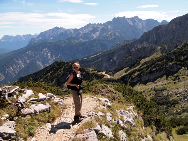
In the above photo, we've left the panorama viewpoint and Frau A is leading the way on the trail.
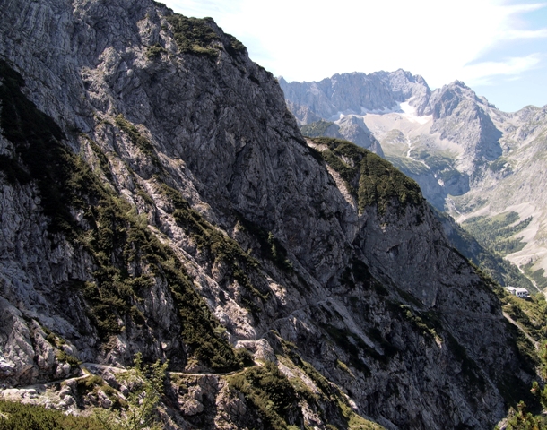
Pictured below, we could see the Hupfleitenjoch ("pass") snake its way through the peaks.
At this point, the Osterfelderkopf (the mountain we're on, taking up the left side of the photo above) is shielding our view of the Zugspitze. As we emerge through that gap ahead on the trail, we should be able to see it...
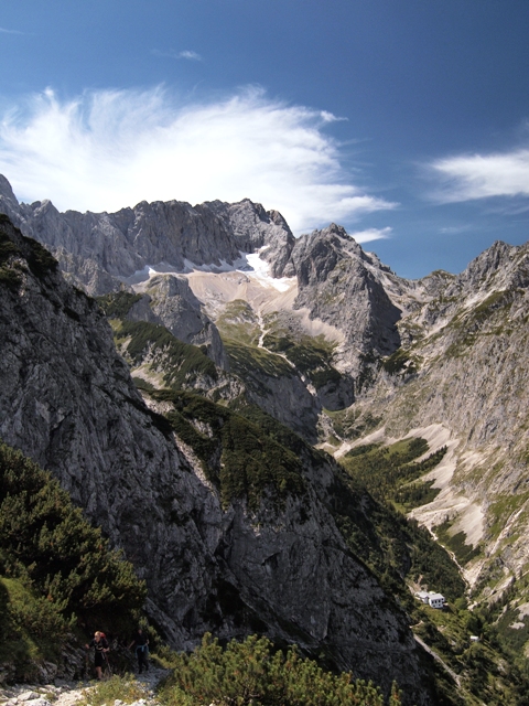
Sure enough, 40 minutes later we make it around the bend and can see the tallest mountain in Germany (below). If you look carefully at the bottom of the photo, you will see the trail (with a couple of other hikers) continuing on the left side, and a small white hut on the right side lying about 300m/1000ft below.
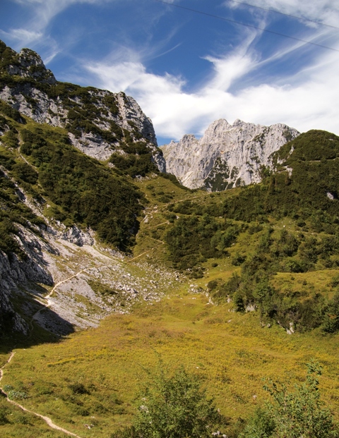
The next photo shows the trail better. It snakes its way along the face of the mountain, and will wrap around and disappear left again before heading back right to the hut. It took 45 minutes to get there from here.
Finally, we reached the hut... and discovered that it is NOT the Höllentalangerhütte that we expected. And it was boarded up. We figured out that we still had another 45 minutes of hiking past this before the gorge starts!
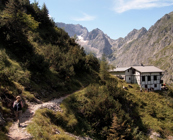
When we finally made it to the right hut, we paused and indulged in a cold apfelschorle and snacks we brought.
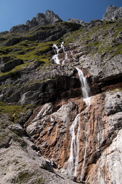
Upon leaving the hut, the trail became hedged in by walls of rock and we started to see hints of the natural forces that created the gorge, like this late-summer waterfall (it's probably much stronger in the Spring)...
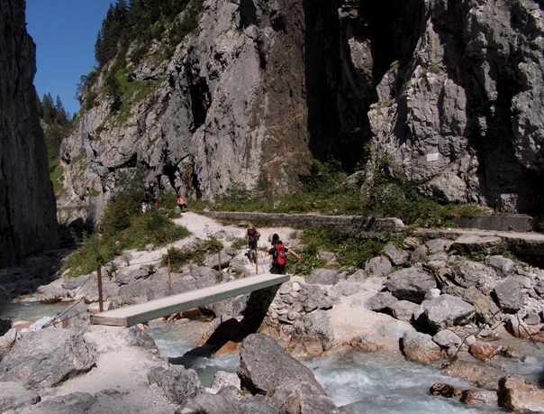
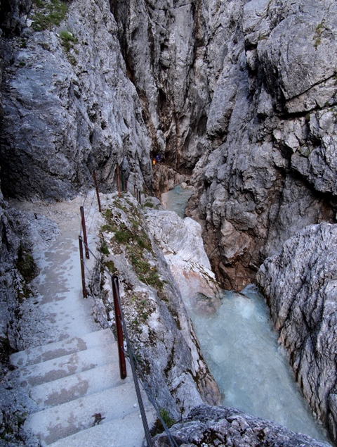
...also as we descended, the water became more powerful and the trail hugged tightly to/over it.
Eventually we came to the last point of direct sunlight (for a while)! You can barely see the top of the gorge, and the trail now becomes steps that descend rapidly along the rock face, traing to keep up with the churning water.
The tiny colored flecks at the deepest part of the photo below are a band of other hikers!
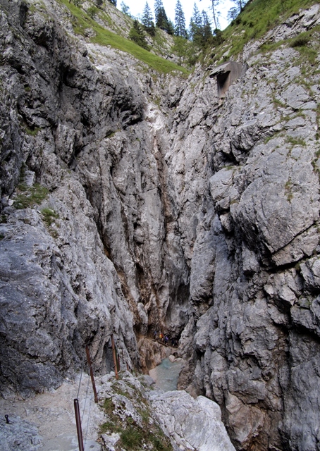
Below is a photo taken a few moments later -- showing better the trail's steps and fellow hikers ahead.
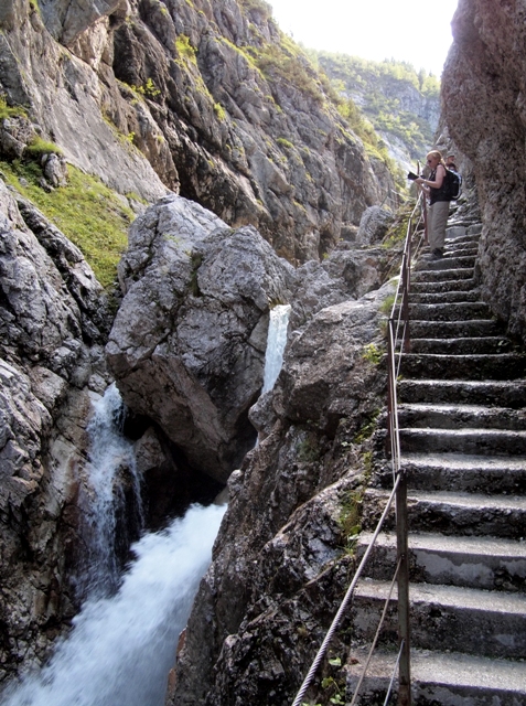
The water on the right just drops off completely to the next small pool below, and is quite noisy now.
At certain points the gorge would open up again, letting in light. This was my chance to photograph Frau A on the stairs -- you can see the rushing water, eroding boulders, and mini waterfalls better looking back up the path.
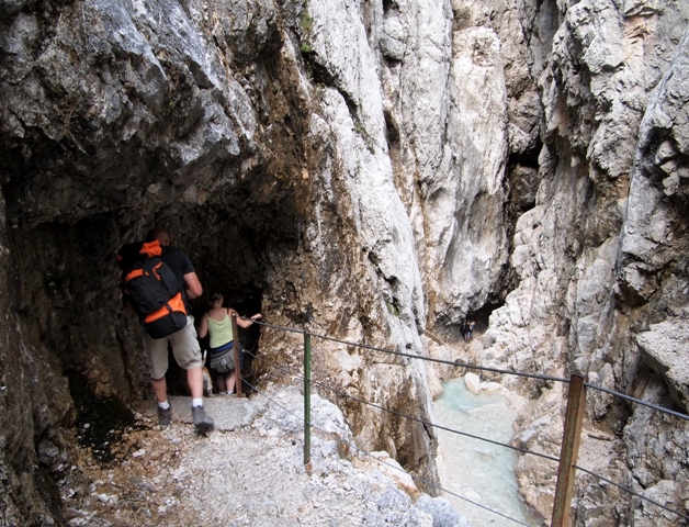
Eventually, the gorge gets so narrow that there is no room for a path anymore -- so they carved tunnels through the rock! Below, some hikers are entering a tunnel on the left, while others have emerged down below.
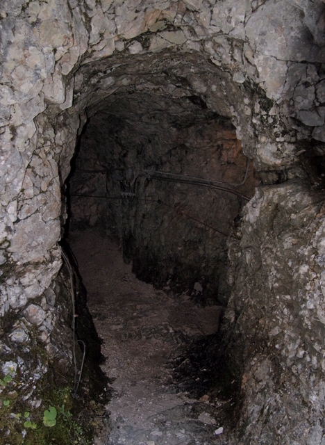
This is what the inside of the tunnels looked like. The wires are running electricity for lights.
Some were dry like this, but others were dripping water (and slippery) and quite cold.
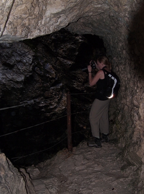
Some points in the tunnels had "lookout windows" that provided a view to the water again (but dark)!
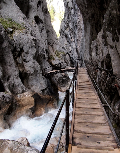
In one place the path had to change sides, so a small bridge was built to connect tunnels on either side.
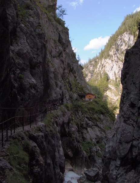
Finally, after 2.7km length and 300m descent, you emerge at the bottom and see the other "hütte".
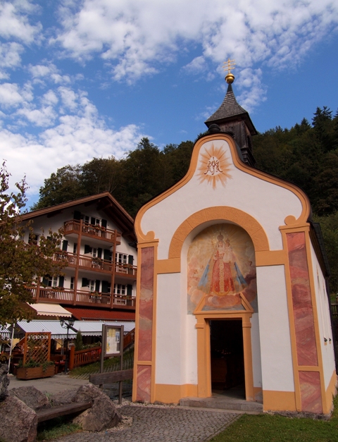
After 30 more minutes walking through a forest path, you reach the town of Hammersbach. On the way to the train station we paused to photograph a small Bavarian church with an interesting bench outside:
It took a while to get there (and we could have taken a more direct route), but it was worth it. The Höllentalklamm is fascinating. For the next time, we're thinking about hiking some trails even closer to the big Zugsptize...
 Herr J ... 3 Comments Travel tagged Print Article Email Article Share Article
Reader Comments (3)
pretty and nature pictures ;)
Spectacular views! I could never go through that tunnel---too closed in for me.
You'd make it, Mom! Herr J.