Entries in Pyrenees (6)

Monday
Mar262012

Pyrenees vacation - Banyuls sur Mer (beach)

On the fourth day of hiking in the Pyrenees, we went way out of our way (and still firmly believe the travel company's directions are at fault!).  So rather than 5 hours, 600m ascent, and 12km... we went 10 hours, 1200m ascent, and almost 25km... finally arriving at Ceret, France.

According to the travel itinerary, we had one more day of hiking to go, from Ceret to the Mediterranean coast.  However, after Day 4, Frau A was beat.  And since we had left the taller Pyrenees and were now in the foothills heading towards the sea, we decided to just take a short taxi to our final destination, Banyuls sur Mer.  So our hiking/hitchhiking/taxi path, in the end, looked something like this:

The weather continued to be great, and when we arrived at the hotel this was the view over town:

Above, you can see their small, crescent-shaped beach.  Of course we headed straight there.

Below is the view in the opposite direction, from the beach back towards the hotel (taken later in the day -- you can see the moon already visible in the sky at dusk):

The view from the hotel towards town was just as nice in the evening, with town lights against the Pyrenees foothills.  Banyuls is large enough to have plenty to do, but still small and comfortable.

The walk along the water towards the beach is nice.  This mosaic (picture below) was just outside the tourist office.  There were also dive shops, boat rentals and tours, and small tourist shops of course.  Unfortunately, since this was early October, many dive shops were closed -- or you had to call for them to come in.  We decided to stick with the plan and hit the beach.

While at the beach, I went for a swim.  Frau A stayed in the warm sun (the water was pretty cold!).  She snapped this photo with my head just above the water (towards the right of the frame).  In addition to the houses in the background, you can see a small terraced vinyard.  More on these in a future post.

This bridge/wall was one border of the beach -- you can see it from our hotel photo too.  The bricks are built around the rock foundation, and give way to the last tip of land forming the inlet.  I walked along this to dry off.

After drying off and warming up again, we decided to relax with some miniature golf!  It is vacation, after all.  We don't love the concrete "greens" but the view with the Mediterranean in the background was great.

At this point, I was in the lead... but Frau A came back and conquered me in the end.  Ugh!

Our deal was that the loser buys ice cream -- so I treated, and we indulged at one of the stands along the beach.  We both tried chocolate, but my second scoop was hazelnut, Frau A's was mint chip:

Ironically, we saw the sign in town marking one end of the major GR 10 hiking path through the Pyrenees.  If only the directions from the travel company were as well marked as this!

As luck would have it, this was the last day of beach-weather that year (this was early October 2011).  The next day, the weather turned blustery -- colder and with strong winds.  We were fortunate to have one good day on the sand.

We had two more days in Banyuls after 4 days of hiking and one on the beach, and there were plenty of things to keep us entertained yet relaxed... (details coming soon in more posts soon)

Friday
Mar232012

Pyrenees vacation - Hike 4, Amélie-les-Bains to Céret

We're now on Day 4 of the "packaged but self guided" hiking trip from the Pyrenees to the Mediterranean coast.  (See Day 1, Day 2, and Day 3 if you haven't read about them already.)

So far, we could not find "turns" on Day 1 and Day 3 that the hiking directions said should be there, and ended up a little lost.  Everything worked out OK in the end, but including other errors in the turn-by-turn instructions, we had to be cautious from here on out.  

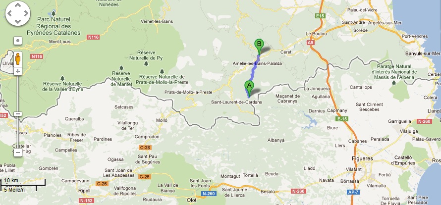
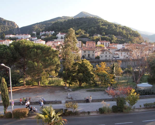
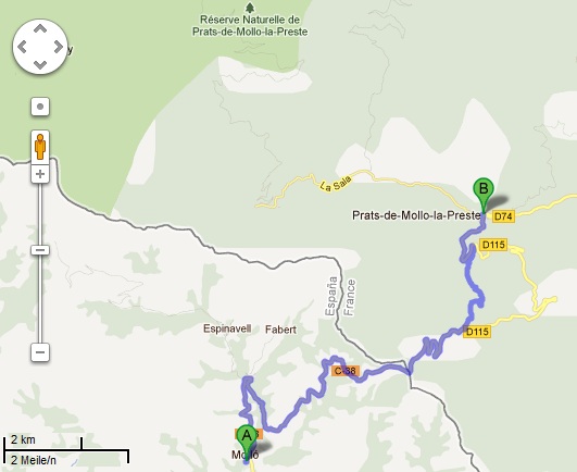
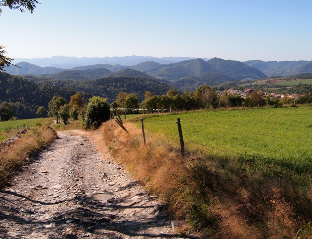
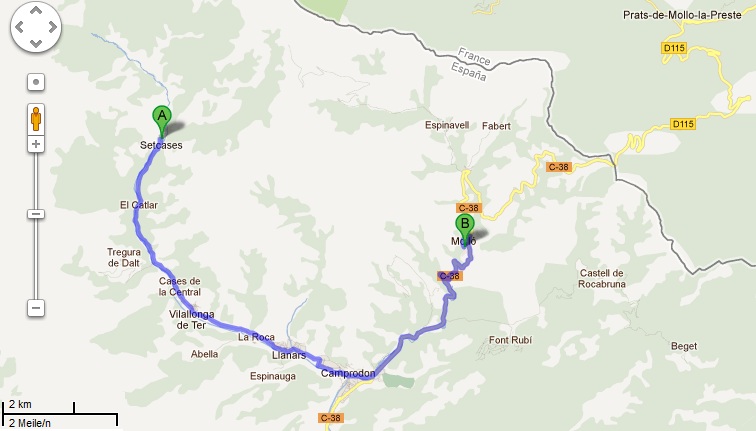
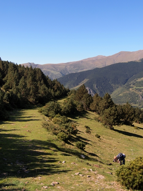
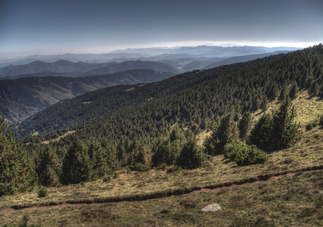
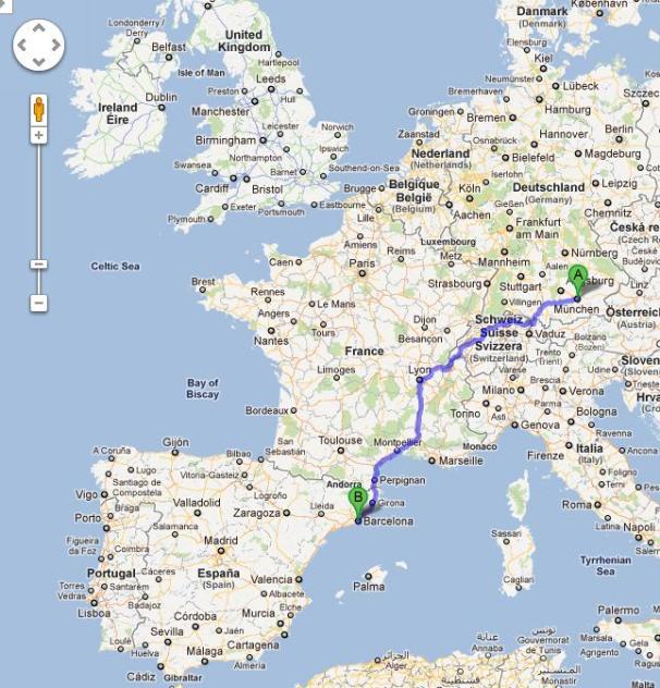
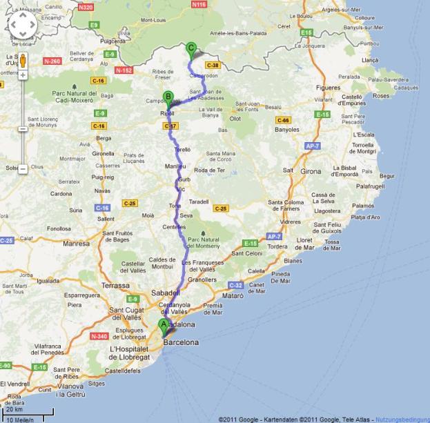
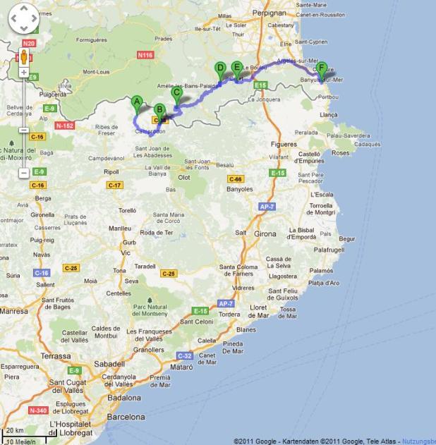
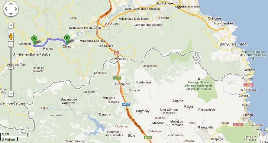
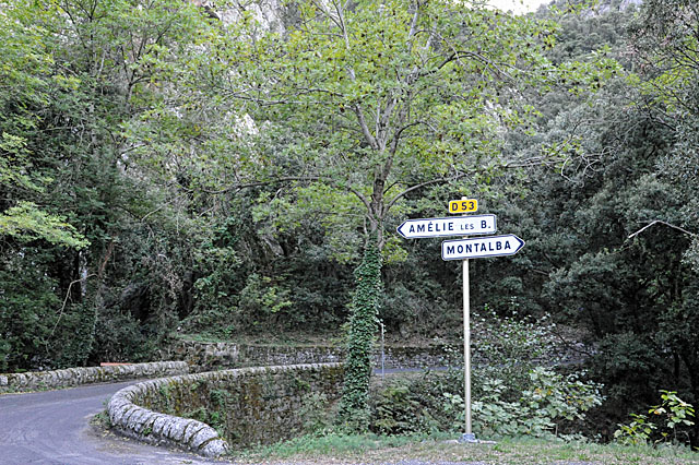
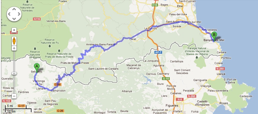
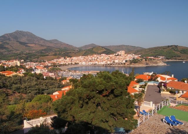
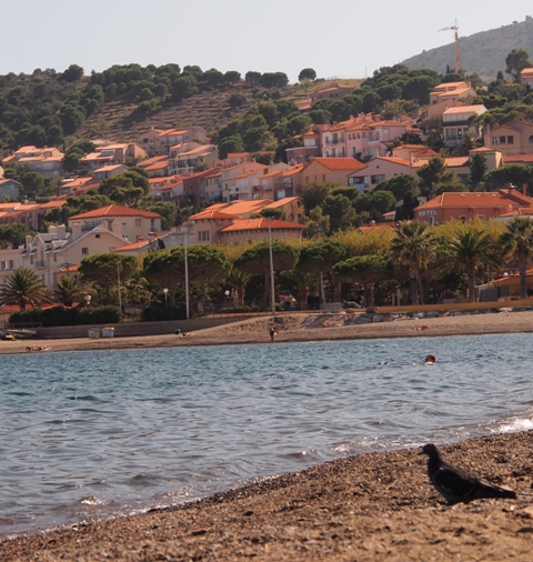
The travel company's plan for Day 4 would take us from Amelie-le-Bains to Ceret, another 650m ascent and perhaps 5+ hours across 12km.  I left the map below zoomed out so you can see how we're approaching the coast - we're still just north of Spanish border too.

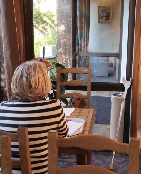
At breakfast that morning in the hotel, a lady sitting across from us brought her dachshund... and had him sitting in the chair across from her!  Look at that face - he's a professional beggar.  It worked, of course.

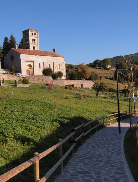
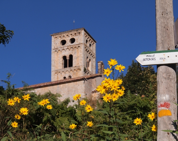
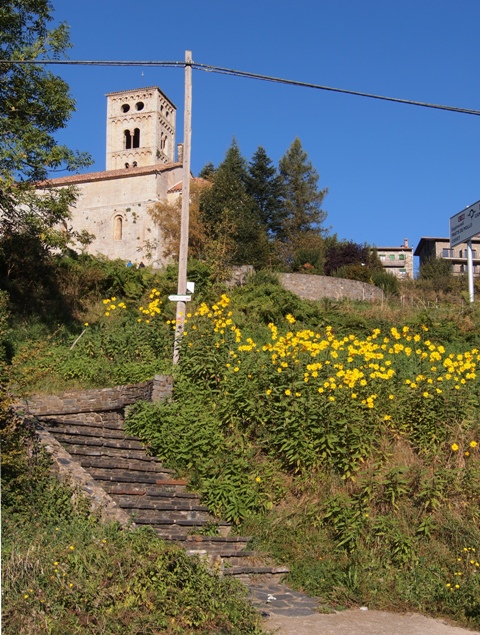
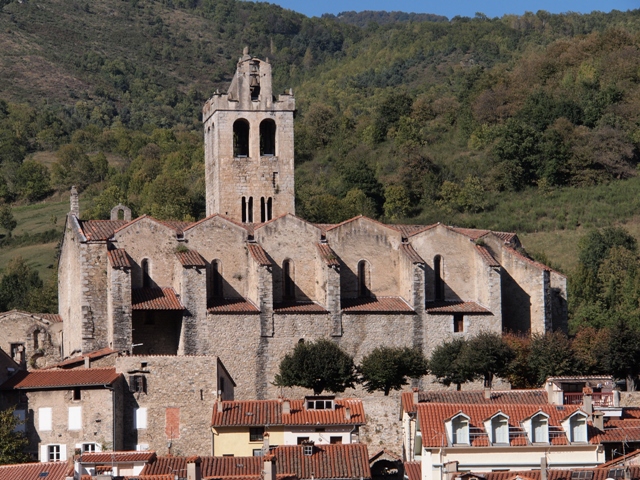
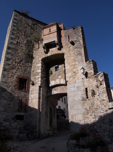
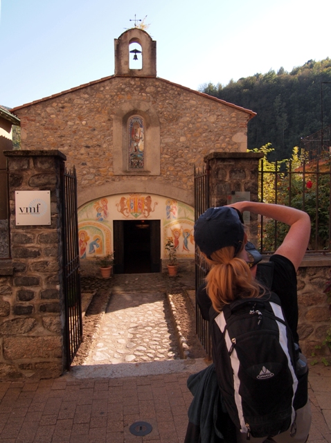
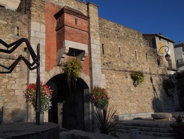
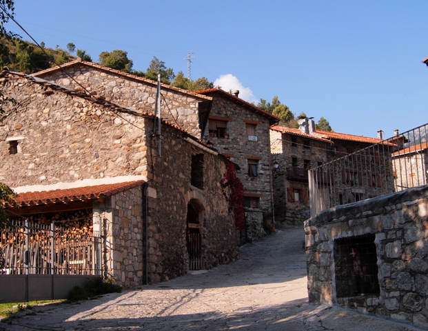
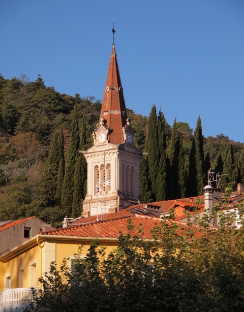
To get to the trailhead, we had to walk through town a bit, and passed one of their larger churches:

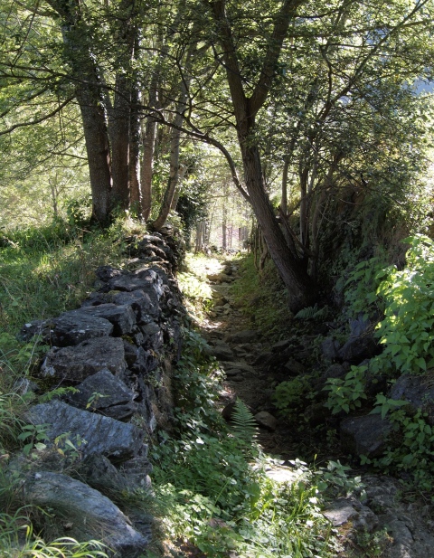
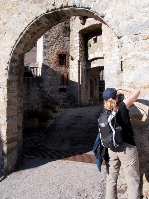
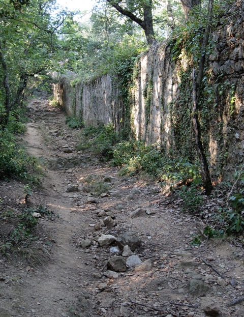
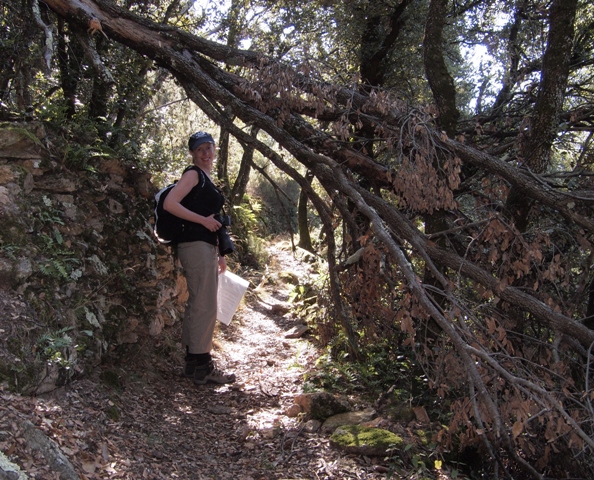
We got to the edge of town, and found the trailhead.  It started by running along an old wall, and under heavy tree cover.  An interesting atmosphere, but pretty chilly without the sun's rays.

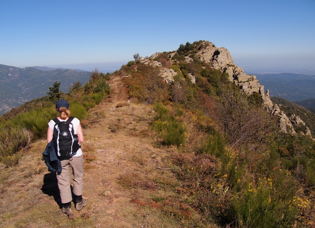
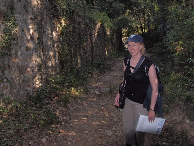
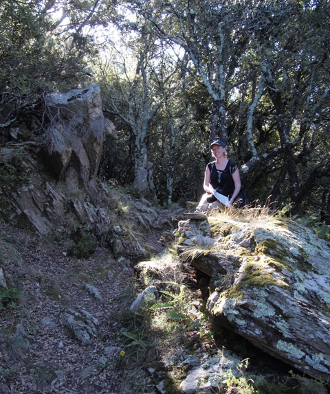
The path kept winding around old walls, and since we had a few turns where we knew we were in step with the instructions, we stopped and took a photo -- so far, so good, but very early.

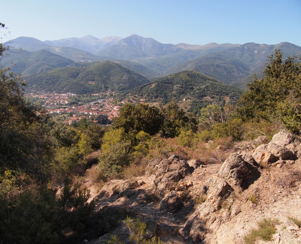
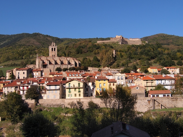
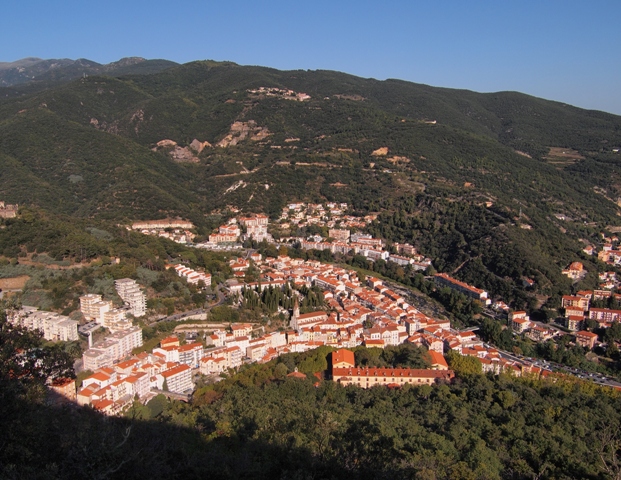
After perhaps an hour, we had ascended to the point where we could see the town of Amelie-les-Bains below, with the small river snaking its way through the buildings.  Another nice day!

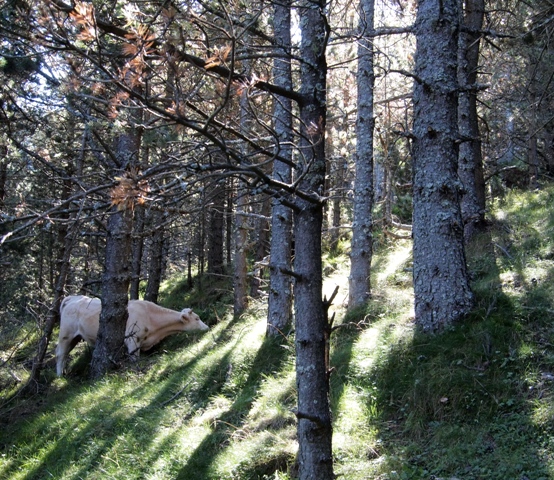
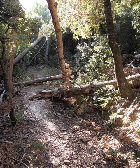
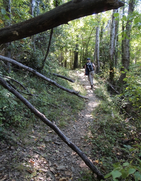
We continued our climb through the forest.  In Germany and Austria, fallen trees like this (below) would be cleared from trails pretty quickly.  We concluded then that either the French and Spanish don't maintain the trails as well, or decide that such minor things are OK and leave them.  Interesting, though.

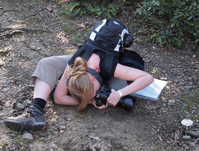
Frau A found this particular mushroom interesting, and stopped (and contorted herself) for a photo:

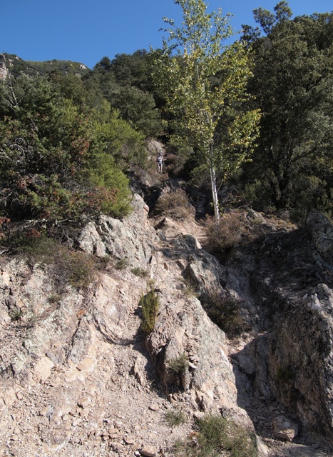
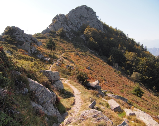
The hiking trail now started winding in-and-out of large rocks...

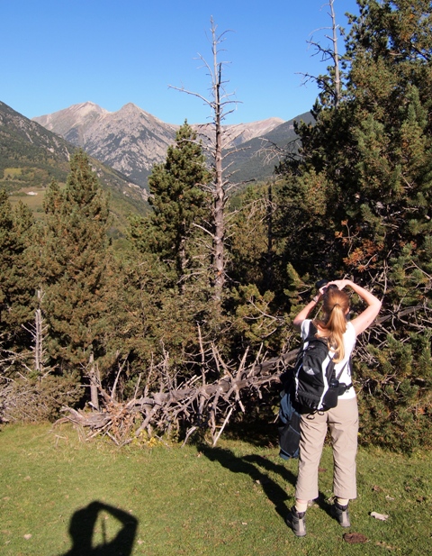
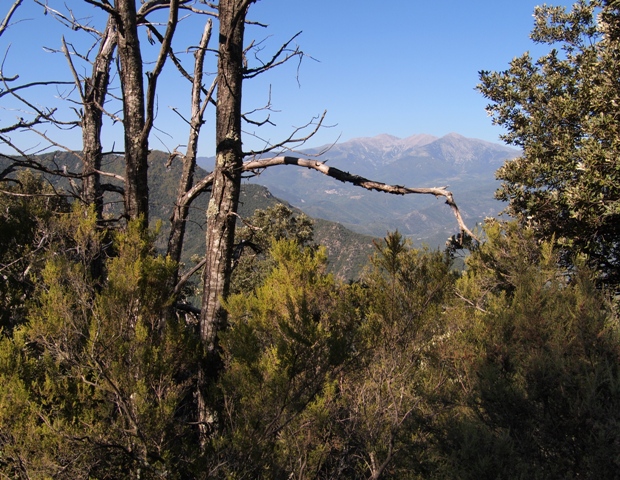
...with glompses through the trees of the mountain peaks across the valley.

At one point, the rocks were so dense that they were almost like steps up the mountain.

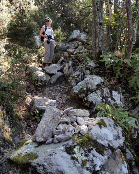
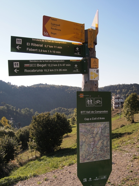
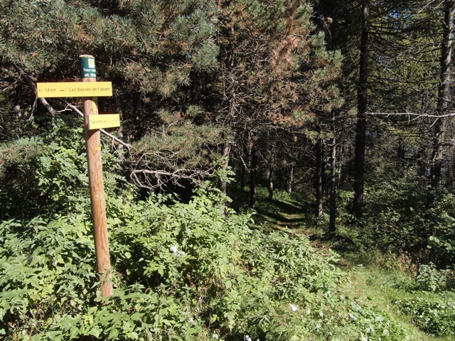
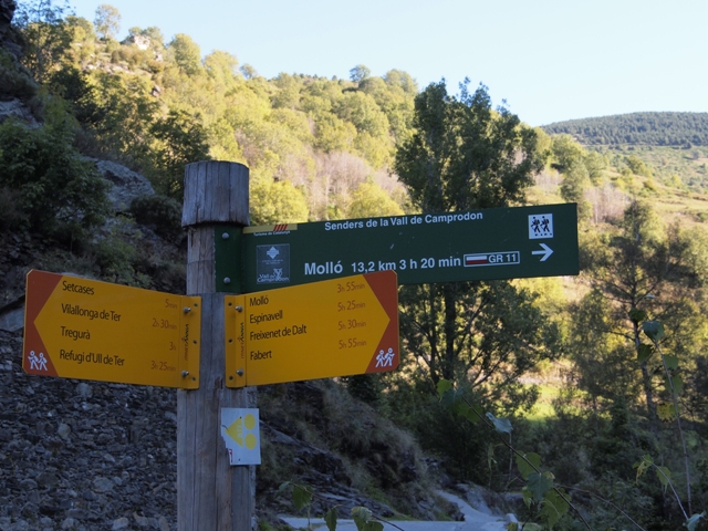
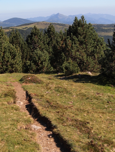
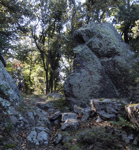
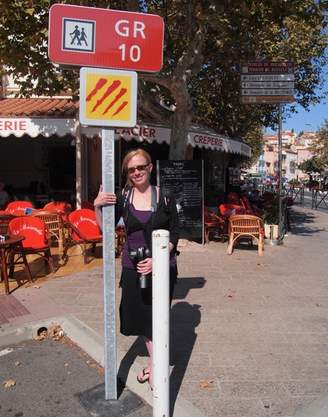
A note here about trail markings:  the major trails are given names or numbers (like the GR 11 that we saw on Day 1) but they are also marked with color.  Look at the photo below, and you can see painted onto the large rock on the right is a horizontal stripe of yellow.  This mark will appear perhaps every 10 minutes on a rock or tree, and lets the wanderer know that he/she is still on the same path.  The GR 11 uses two stripes, one red and the other white.

This is, of course, very helpful (and part of the regular trail maintenance that we mentioned earlier).  The instructions from the travel company would almost always reference these, saying things like "after 20 minutes and Xmeters incline, take a right at the fork and continue following Yellow".  Just a FYI, but this is important later in the story...

Below, more interesting fallen trees along the trail:

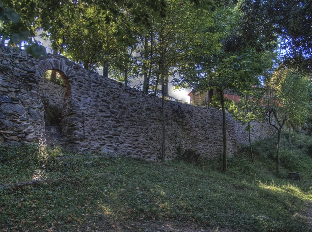
After a few hours, we arrived at a wall of a French farm (and in line with the directino too!).

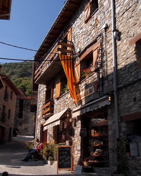
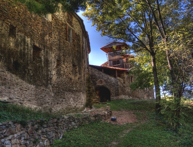
A little further down we could see buildings on the other side.  Everything stone - very cool.

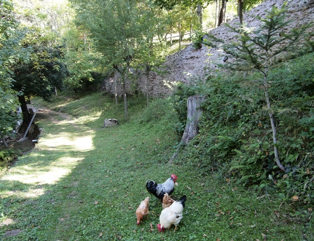
This is looking back from the way we had come, the the chickens we had to walk around!

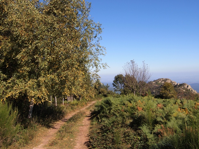
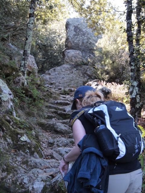
So at this point, we're on track and have had some nice sights too.  Back into the woods for more climbing.

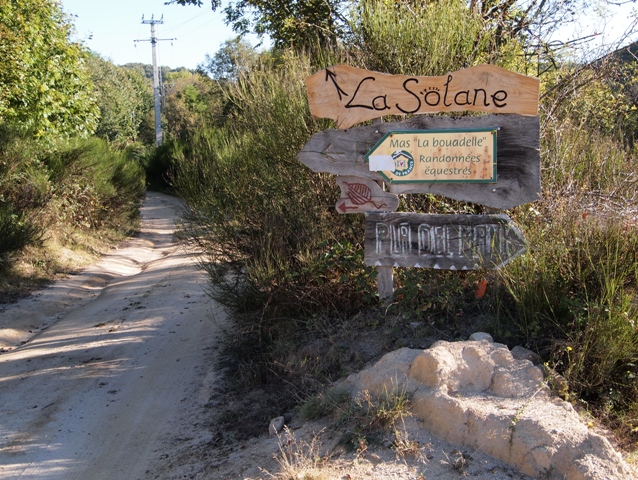
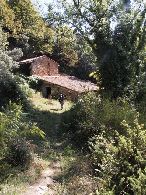
We even arrived at an abandoned farm building, just as the directions said.  Again, very cool to see.

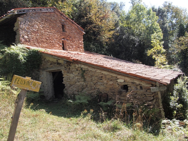
The old sign is still there:

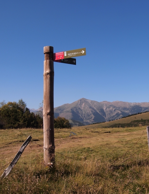
Not long after this milestone, however, things got worse.  There was a cross in the road, and we had to follow the correct path.  The problem was this: the sign pointing to our path was a ambiguous.  Below is the picture of our dilemna.  We were coming from the bottom, hiking upwards, and had to interpret the sign.  Is the sign pointing to the path going upwards, or is the sign telling us to follow the path going from left to right???  Do we continue the same direction, or turn right???

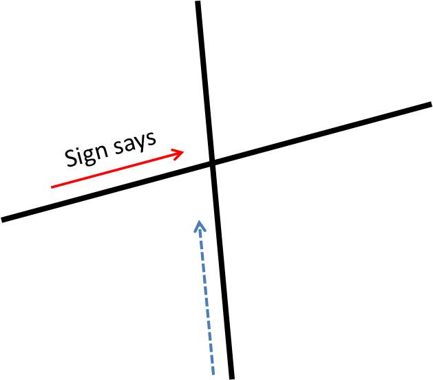
It's not so easy on mountain trails, either, because they wind so much -- switching back to make an ascent.  So you can't just decide "that is heading the general direction we want" because the trail may swing around rapidly.  We eventually decided to turn right -- that the sign was point along the trail rather than to the trail.

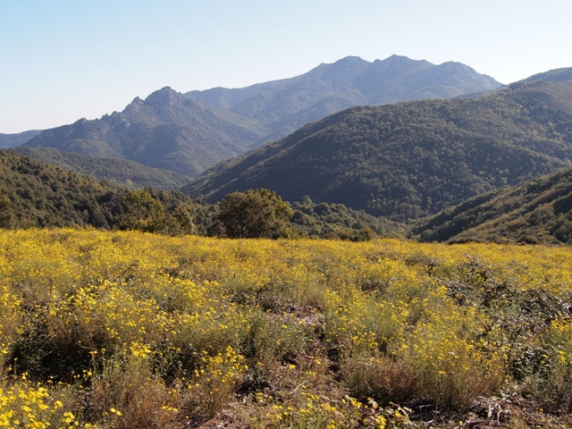
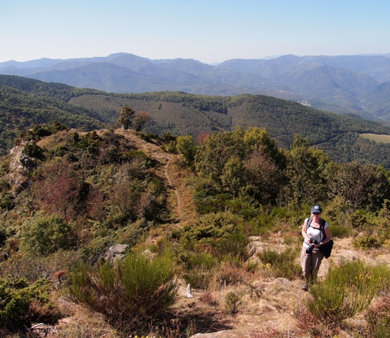
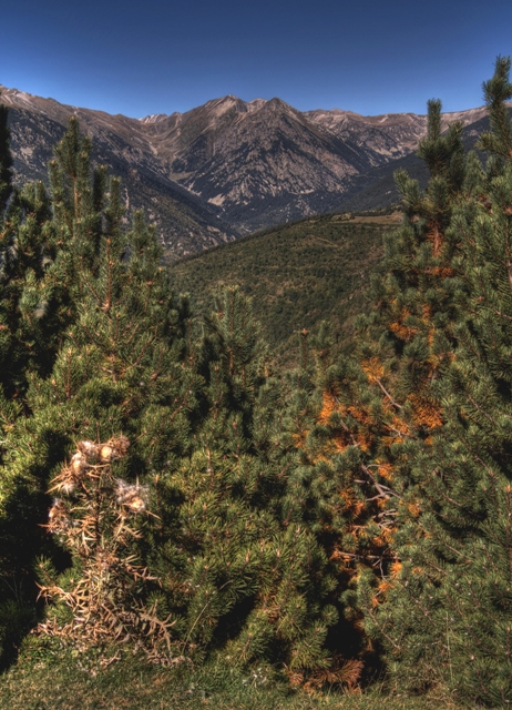
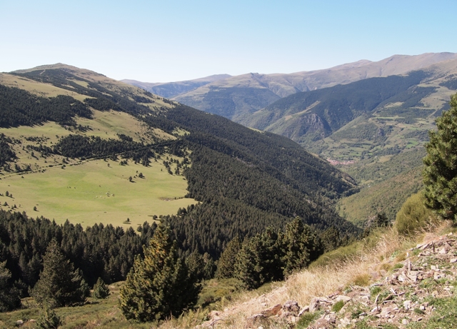
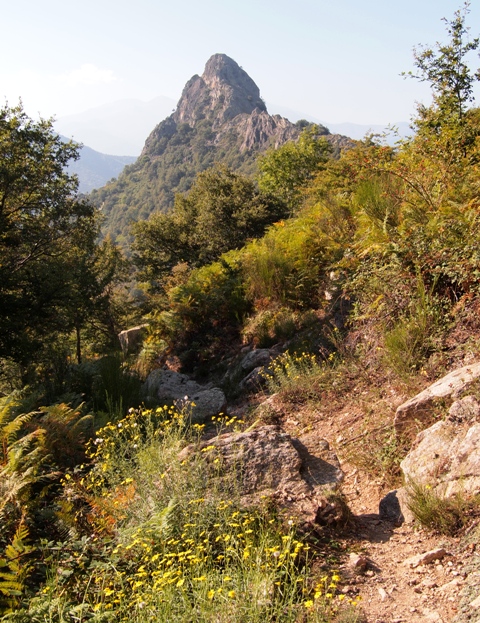
Interestingly, we continued to see the correct color markings on this trail, so it seemed that we had chosen correctly.  We saw this peak ahead, and hoped that this was the top of the climb that day, and that we would from there descend to Ceret.

Although we were still getting the right trail color markers, they were not as fresh and consistent as before... not a good sign.  Even worse, we encountered yet another peak on our path (below) that we had to go around, which added even more ascent.  We were getting higher, not lower, and these twists and turns were not in the directions.  Lovely view though!

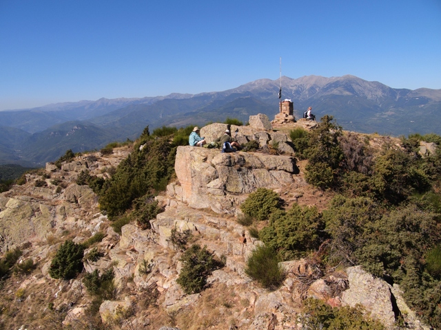
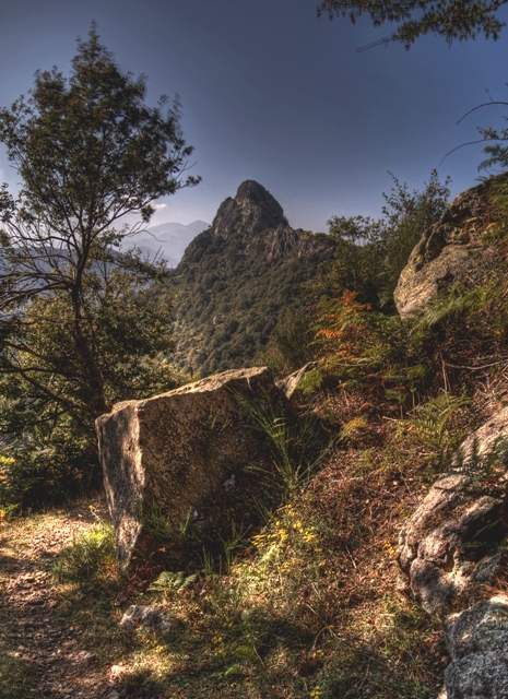
(We obviously still felt OK enough to stop & take a bracketed photo for later HDR processing):

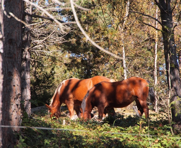
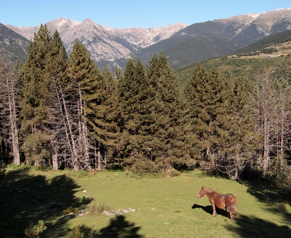
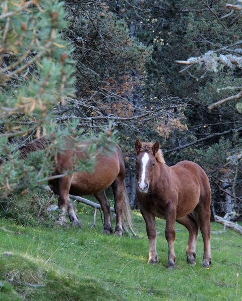
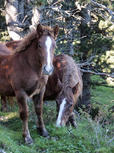
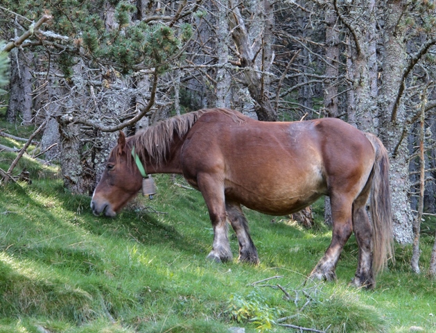
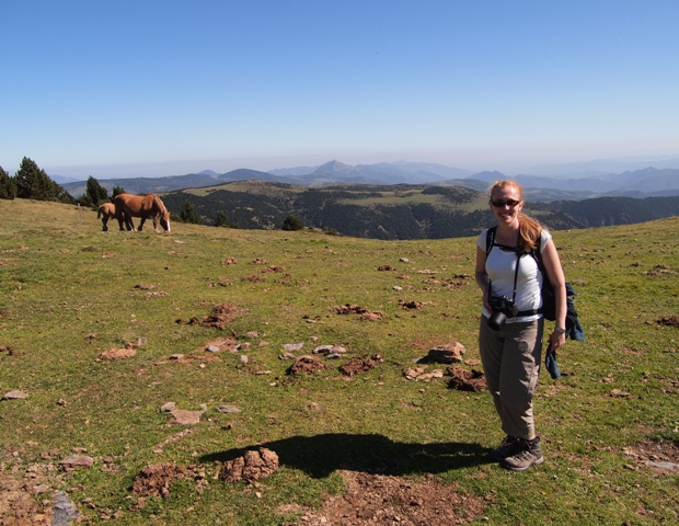
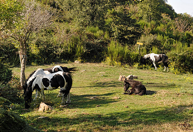
After a few more hours, we were getting concerned.  The trail color markings had stopped (and there were no turnoffs that we could have mistakingly taken).  This made no sense.  Eventually, we came to a high clearing with horses grazing - interesting!  Even better, there were two signs at the edges of the clearing (look at the yellow one back right, and the second one on the back side of the tree, left).  We discovered that we had indeed taken the wrong way, and had gone South instead of East.  Waaaay south.

What was most irritating was that the trail had teased us with the right color markings for a while.  Ugh.

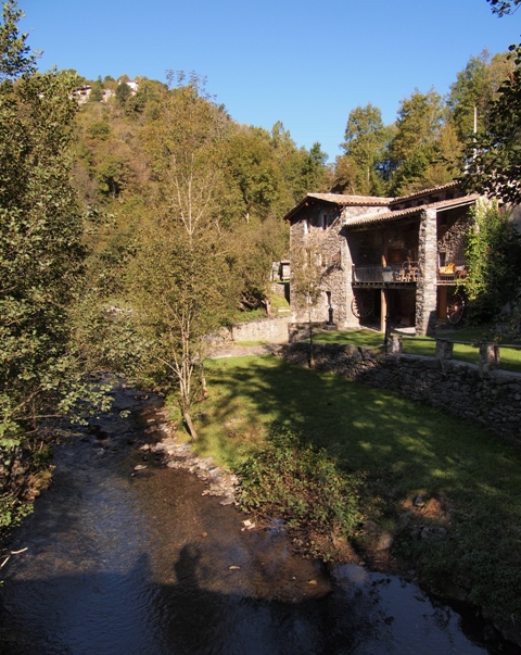
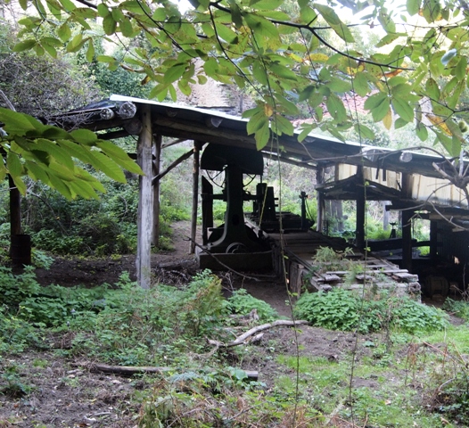
We had now two choices:  return the entire way we came, or continue on a loop back to Amelie.  Those were the only options.  So we decided to at least keep seeing new things, and continue the circle back to Amelie.  We were rewarded with the ruins of an old mill:

Unfortunately, we realized that we had gone 3 miles out of our way -- and done a total ascent of 1200m !!!  This was twice the climb planned for the day, and returning to Amelie would put us at 25km total... also 2x the distance in the printed plan.  We were getting tired, and it was starting to get dark again.

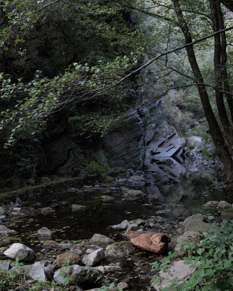
You can see how it's getting dusky as we finally got back down to the river-level:

(And, of course, the obligatory bracketed and HDR'd version of that same shot, below.)

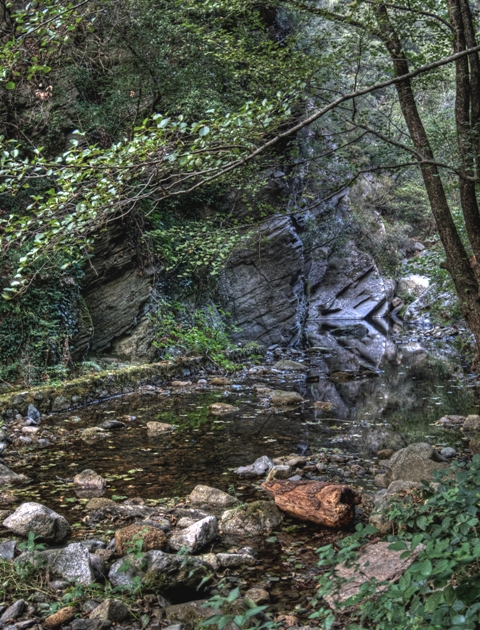
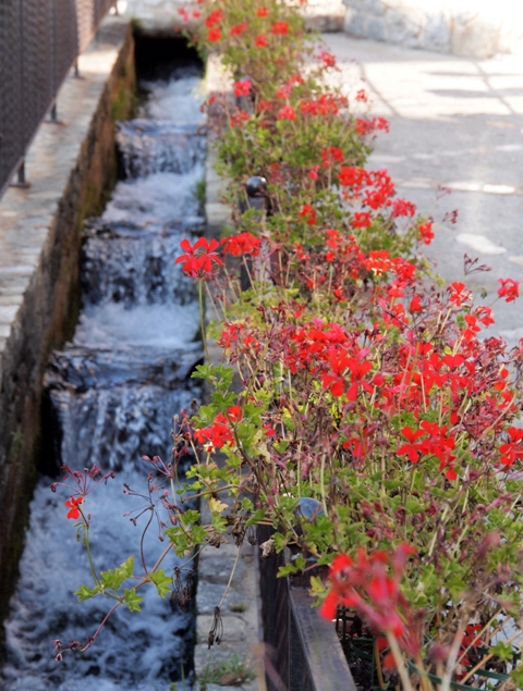
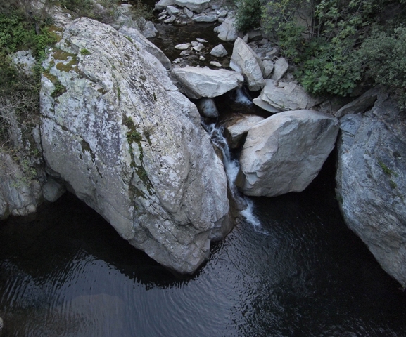
The river had some great rocks and mini-falls too:

At one point along the river, we came to where it crossed a road.  Frau A was beat, so we decided to walk along the road back to Amelie and see if anyone would give us a ride.

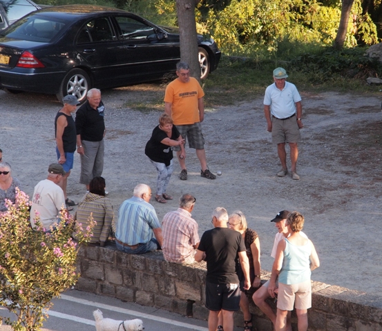
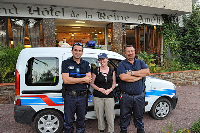
One car came along, going in the wrong direction.  Sure enough, as our luck was going, the next car that arrived was a police minivan!

We waved them down, but had a problem:  neither of us speak French well.  We showed them them map and drew and hiking path that we had taken.  They faces showed how shocked they were at how far we went that day, and when we said the hotel name they understood our request.

They invited us to climb in... but wait!  One of the two policemen had to clear off the back seat.  He didn't want us sitting on the wild mushrooms.  Yes, the French policemen had stopped to pick wild mushrooms, which were laying on the back seat.

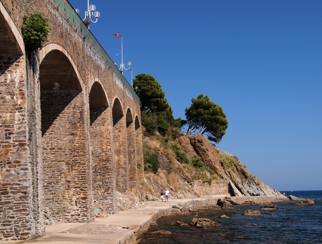
As soon as that was taken care of, we got in.  As they drove, we tried in broken French to have a concersation.  They were very friendly.  In fact, they stopped along the way and showed us a "secret lookout" -- we ducked through some dense bushes and came to the edge of the rock face, looking down over the town.  They said it was one of the nicest views around -- the photo below doesn't really do it justice.

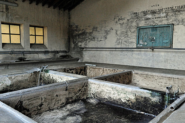
Even more interesting:  as part of their duties each evening, they have to close and lock the old thermal baths in town.  They invited us in and we took a photo of the baths (below).  Cool!

They dropped us off at the same hotel where we started that morning.  We said thank you often and loudly, and then took a taxi to Ceret.  THANK YOU FRENCH POLICEMEN!

What was quite an adventure.  We were incredibly frustrated with the directions (or our inability to figure them out, in German and all) but ended up with a much more interesting hike than the plan would have given us.  Plus, we again had luck as kind Frenchmen gave us a ride, and we knew it'd be a great story.

And there are still a couple days to go, to be documented in the next blog posts...

Tuesday
Mar132012

Pyrenees vacation - Hike 3, Coll de Noell to Amélie-les-Bains

Despite a few unclear hiking directions on Day 2, we felt pretty good heading into Day 3.  We again got up early, thoroughly translated the instructions from German at breakfast, and put water in the backpacks.

Today we would be heading mostly north, further into France.  On the Google Map below, you can already start to see the Mediterranean Sea and our final destination of Banyul sur Mer.

One unique part of this day's agenda was that the hike would start outside of town -- they provided a taxi to get us to the starting point.  Day 2 ended in Prats-de-Mollo, but Day 3 started in Coll de Noell.

The taxi basically dropped us off in the middle of a dirt road.  50m further, a hiking path veered off right.

The first hour or so had a completely different environment than the pine forests of Day 1 and 2.  It seemed much drier here, dominated by grasses, wildflowers, and shrubs.  And the sun was really beating down.

For a while were were hiking along farmer's paths, and slong some woods that were small deciduous trees.

Eventually, we ascended beyond the farms and up to the peaks that we had to cross in order to reach the next town.  These mountains were a little more dramatic that what we had seen so far.  You can see the narrow trail heading up to the first apex - we would have to do two of these today.

Looking back, the hiking path snakes its way back and disappears over the ridge we had just climbed.

The second peak was even more photogenic.. and we had some company!  Two Frenchmen had already arrived and were having lunch.  We said hello, and opened our packs for food and water too.  The guys were NOT doing the Wikireisen tour -- they just lived in the area and were having a nice day in the mountains.

As we started the descent towards Amelie-les-Bains, the way became quite rocky.  Oddly, this was more difficult to do that a grudging incline.  But we took it slow and steady, and so far all directions looked good!  No problems... yet.

Eventually, through a clearing we could see a town in the valley below - presumably our destination.

Unfortunately, this is where the directions failed us again.  For you doubters out there, check out all the hiking we have done in Germany and Austria - and I promise we double check and backtracked twice... but there was a turnoff the directions noted we should take that did not exist.  So we kept on the main trail and headed down towards the town (that's Frau A coming down the trail, below).

We did arrive in town... but unfortunately about an hour walk from the part of town where our hotel was.  We asked a man driving along the road to clarify directions - not so easy with our terrible French.  However, his eyes lit up when he saw the name of our hotel, and he motioned to get in the car.  Why not?

Yet again, fate dealt us a great hand.  This man was friendly (singing to himself in the car) and dropped us off right at the hotel!  That was nice, because it gave us some time to shower before dinner.  I took the chance to take photos of the locals playing bocce next to the river, outside of our hotel window.  My favorite is the man in yellow shirt, tie, and hat.  He liked to be the judge rather than play the game.

So ended Day 3.  Mostly on track, with an instructions problem towards the end of the day that landed us an hour outside our destination.  But we had some luck again, and all worked out well.  It was another day of hiking 12km, ascending 650m, experiencing the Pyrenees, and ending with a nice dinner - we slept well again that night.

As you'll read in the next post, Day 4 had more dramatic surprises in store for us...

Sunday
Mar112012

Pyrenees vacation - Hike 2, Molló (Spain) to Prats-de-Mollo (France)

After the experience on our first day of hiking with the Wikireisen package, we decided to be a bit more careful.  In retrospect, were are spoiled by the incredibly well marked and managed hiking trails in Germany, Austria, and Switzerland.  We blindly assumed that hiking trails everywhere are so well signed.  Of course, the problemn could lie with the Wikireisen directions themselves... we'll see.

The second day's hike would take us across the border from Spain and into France's Pyrenees.  There is a nature reserve nearby (see map below) and the scenery promised to continue to be gorgeous.

In the spirit of caution, Frau A and I got up even earlier and spent a long breakfast translating in detail the hiking instructions.  We would manage the twists and turns more carefully today, even if it took some of the relaxation out of the experience.  Better than being lost in the mountains.

After we had made copious notes, we departed from the hotel in Mollo.  Incredibly, the very first instruction was unclear.  It said to "exit the hotel and turn right".  The problem:  the hotel sits on a street corner, and there are two exits!  Therefore, depending on which exit you took, you would take a different direction.  We weren't sure if this was hilarious or depressing, but it was casting doubt more and more on the directions from Wikireisen.

Fortunately, we figured it out quickly and headed down into the valley - with pretty views of the town church.

Today, we would be heading downwards first, and then go up and across a mountain to Prats-de-Mollo.

For the first hour -- after the first instruction, anyway -- things were going smoothly.  We identified every intersection and turn, and were rewarded with signs comfirming our path and position.

Unfortunately, we came to an instruction that said to turn right and follow the covered path.  Of course, the covered path went left at the Y-junction.  We guess correctly that the covered path was more important than right/left indication, but confidence was not high in the directions at this point.

The covered path was very rocky but beautiful.  At least that was worth the moment of confusion.

We emerged by an old mill alongside a small river.  Really nice.  Like the day before, we were basically alone on the trails, with complete peace and quiet (but nobody to ask for confirming directions either).

After crossing the river, we started the day's ascent.  After 1.5 hours we could look back over the valley.

Sure enough, we ran into more mountain horses.  (I.e., another stop for Frau A to take photos!)

After another hour ascending in the woods, we reached an elevation that was clear and grassy.  Right in front of us was a stone marker -- we had reached the Spanish-French border!  Still on track for that day too.

The weather was again beautiful, so we decided to have our lunch here along the border, in the sun.

Even better, signs continued to confirm that we were following directions correctly.

So we crossed into France and started the descent into Prats-de-Mollo, again going through the woods.

An hour later we walked by a farm with two donkeys - wish we had brought sugar cubes for them.
They were much more curious than the horses or cows, and not afraid to come right to the fence. 

Then in the early afternoon, we emerged from the woods with a view of our destination.  We could see the church and fortress dominating the hill on which the town sits.  Very satisfying.

We entered the town through the old stone wall & gate.  Very cool.  Frau A had to take some photos here.

Walking past the old walls was a great reward for the day's hike...

...plus there were some smaller churches that looked lovely.

We had one more arch to go through, and then on to the hotel, for showers and then dinner.

Day 2 was pretty satisfying.  There were some glitches in the hiking instructions that continued to give us pause.  But we made it, had gorgeous scenery and photos, and lots of fresh air.  Just a great day.

As you'll see in the next posts, the ominous signs of bad instructions turned into real problems... but we found a way.

Friday
Mar092012

Pyrenees vacation - Hike 1, Setcases to Molló

In the prior blog entry, we introduced our "individualized" trip:  an organized 5-day hike from the edge of the Pyrenees to the Mediterranean coast.  It was structured by a travel company (a different hotel booked each night), but we would actually execute it on our own - no guides or groups.

The first hike was from Setcases to Mollo, both in Spain.  (Although you can already see the French border on the Google Map below.)  It's not the high Pyrenees, but still a hike of 650m ascent over 13km in that day's plan.

Below was the sign that greeted us at the start of the day.  This trail section is part of the major GR11 route across the Pyrenees, so we hoped that it would be well marked with the red/white stripes the whole way.

Our first steps were across a mountain stream, with the same flowers we saw in town (Setcases) on the bridge.

After 30-45 minutes of immediate incline, we reached a relatively wide, flat, grassy track through the woods.
We stopped frequently to take photos of the peaks across the way.  It was a beautiful, blue day in Spain.

The woods here were dominated by pine trees and rough shrubs along the trailside.

One thing we did NOT expect was to see cows in the mountains.  We learned, in fact, that the locals let them graze freely and just round them up a few times each year.  They were quite skittish and afraid of people.

The next surprise was to see horses in the mountains, also roaming freely.  As with the cows, people here let them take care of themselves and find them a few times each year.  What was a little disturbing to Frau A is that the horses are used for food!  (We'd seen Spanish dried horse meat on menus in Munich, and here they were.)

They were very nervous as well, but we snuck through the trees for a few closer photos.  This one was young and liked to stay close to mom... but still curious of us nonetheless.

To help people track them down, many horses wear bells like the one in the photo below.

In the next photo, you get a much better view of the wide, grassy train we were following.  No problems so far.  Until this point, we were following the GR11 and would see the red & white stripes marker periodically.

We caught this guy sharing our path, but he beat it as soon as we came around the corner toward him.

At this point, we could look back and see how the trail wound its way around the side of the mountain.

We then came to a point with a great view across the Pyrenees - peaks are far as the eye could see.  This is where the instructions told us to leave the GR11 (to take a path down to the next town).

Frau A took this chance to pose with the horses that were sharing our lookout point.

Unfortunately, things started to go poorly from here.  Our printed map and turn-by-turn guide sent us onto this narrow dirt track.  That was fine, except the instruction (remember, printed in German) told us to look for a fence on the left, go through the gate, and continue on the trail to Mollo.

We never found the fence, and therefore not the gate, and therefore not the path to Mollo.  We backtracked twice and checked each direction carefully, but just could not figure it out.  These cows couldn't help, unfortunately.  At least the weather was perfect - not too cold or hot for extended hiking.

It's funny.  Even though she's tired, somewhat lost, and it's getting on towards dusk, Frau A still wants to take photos of animals!  She would have taken one home with her, if it were possible.

At this point, it was starting to get dark.  We spent a LOT of time taking photos, and after backtracking twice to try and find the turnoff that the instruction said we should follow, we put away the cameras and headed to one place we knew existed and hopefully find some help.

Because this was already early October, peak season for hiking was over.  There were almost no people on the trails with us.  Fortunately we remembered passing a small turnoff into a national park, where earlier we had seen a few cars.  We hiked there as fast as possible... and luckily found one family left.  They were having a picnic.  Frau A asked them for help in Spanish.

Unbelievably, they offered to drive us to Mollo - where they are from.  They did not know the fence and gate the instructions mentioned, but since we had already hiked 15km (and probably 1100m total ascent) we didn't feel guilty about accepting their offer.  We had hiked more than in the plan anyway!

Ironically, it was a great way to end the day.  Their kindness was a reaffirmation of how nice people can be.  On the other side, we learned that we cannot trust the given directions from Wikireisen blindly.

The next hikes proved to be just as "interesting"... coming soon.

Wednesday
Mar072012

Pyrenees vacation - a self-guided experiment

(Sorry for the lapses in posting here - I'm back in action.  Thanks for understanding - Herr J)

Do you remember that I asked Frau A to marry me at Oktoberfest?  She said Yes, and the very next day we left for a week-long hiking trip.  This trip was destined to be interesting because it was a hybrid between a guided tour and a do-it-yourself vacation.  Here's how it worked:

A German travel company called Wikireisen offers multi-day hiking packages that go from hotel to hotel (or hut to hut) through the Alps or Pyrenees.  They offer other trips as well (biking, walking, etc.) in many different countries around Europe.  The idea is that they provide the structure of the trip, but you're not constrained to being herded with a group each day.  They call it "individualized travel".  They book the hotels (your start and end points each day), provide maps and outline the hiking routes, but you hike the route on your terms.

What made it appealing to us is that the plan details are (supposedly) fully and professionally prepared, but you execute it as you want.  Are you a late sleeper?  Most hikes each day are 5-6 hours, so just start at 10:30 and you'll be in the next town by dinner.  Frau A and I planned to start earlier, because we take so many photos that it slows us down.  In the heavy tourist season, many people will be booked in the same hotels, but would depart and arrive according to their hiking speed and preferences.  A pretty interesting concept, right?

So the next morning after the Oktoberfest proposal, we flew from Munich to Barcelona.

We selected a hiking plan through the Pyrenees, so upon arriving in Barcelona we took the train from the airport to the main station.  We bought tickets, and hopped the next train to Setcases, Spain:

The adventure we bought from Wikireisen included 5 hikes:

Day 1:  Setcases (Spain) to Mollo (Spain)

Day 2:  Mollo (Spain) to Prats de Mollo (France)

Day 3:  Taxi from Mollo to Coll de Noell (France), from there to Amelie le Bains (France)

Day 4:  Amelie le Bains (France) to Ceret (France)

Day 5:  Ceret (France) to Banyuls sur Mer (France)

In short, this would take us over 5 days from the Pyrenees to the French Mediterranean coast.  Very cool. 

We were quite excited when we finally arrived in Setcases, so before dinner we walked around the small town a bit.

In addition to the stone buildings, there were some water passages that (we think) help direct mountain run off.

A few stores were open, but we weren't there for shopping.  (Although the olive oil looked quite tempting.)

We weren't sure if this was the home of someone who loves plants and flowers, or a closed flower shop.

Setcases is quaint, but we took a quick dinner so we would be ready to start early the next morning.  The hiking directions were in German, so that made things a bit more complicated.  Frau A speaks Spanish, but neither of us speak French, so local help could be an issue at some point...

In the next posts, we'll share a hike-by-hike account of the adventure.  Lots of photos.  Stay tuned,.