


Munich Day Trip - Spitzingsee
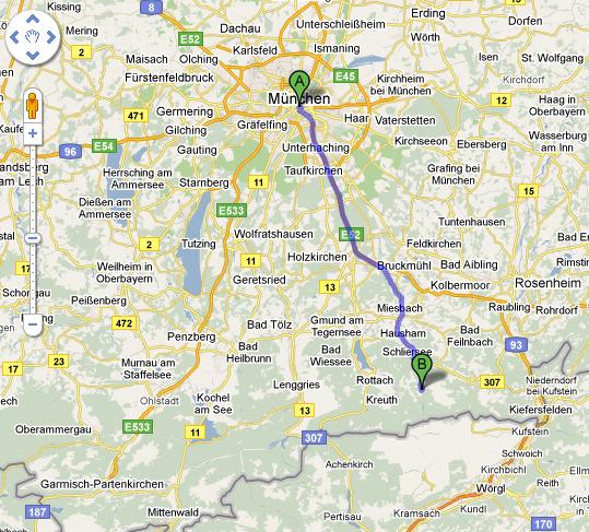
Yet another nice one-day hike near Munich is to the Spitzingsee. As usual, the day starts by driving south... but this time we stop short of the Austrian border and remain in southern Bavaria. (And as usual, leaving early helps avoid traffic on the weekends, but the autobahn will be packed on the way back. No way to avoid it.)
I found a nice map of the lake and surrounding mountains (click on it for a full-size PDF) on a local tourist web site (German, sorry). You can see the Schliersee in the middle, a small town at the foot of the lake on the left, and two ski-lifts flanking the lake on each side. I've never been skiing here, but we're not in the "big" Alps yet so slopes will be gentle and short. The lifts are also open in summer for hikers who want to take it easy, or those that stayed too long having beer at the huts(s) and need to get down quickly.
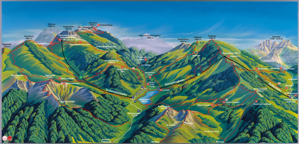
On this day I took the path that starts at the base of the Stümpflingbahn at the upper right corner of the lake in the map above. In the morning, I took the path "up" from the lake going towards the Becksteinhaus ("north" on the map), then veered right ascending to the Roßkopf. The first photo below is on the way to the top, looking back into the valley and lake.
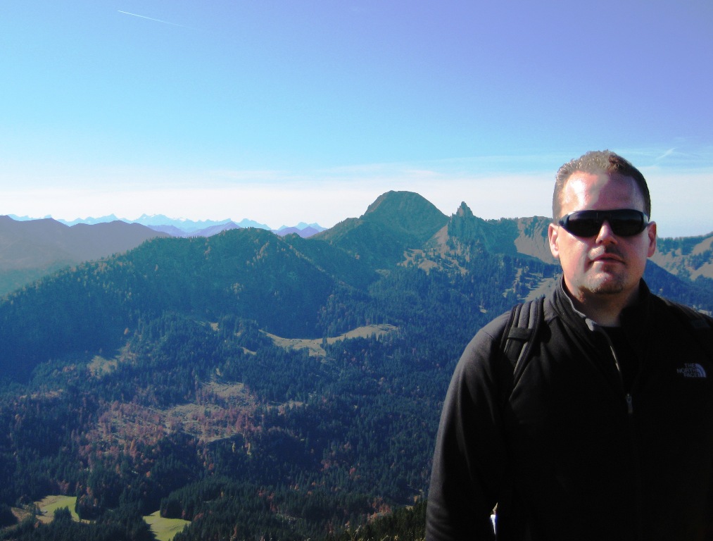
I think the next photo is looking in the other direction, away from the lake this time, over the background peaks. As usual, it's cool in the morning but with good sun you're soon in t-shirt only -- but bring the fleece in any event. The lake itself sits at over 1000m elevation, but the surrounding summits max out at 1600m, so it's only a 600m difference. The hike therefore takes maybe 4 hours round trip, depending on the duration of the pause at a hut for food and drink. The paths are clearly marked here, almost impossible to get lost, and enough fellow hikers that there's always somebody else around just in case.
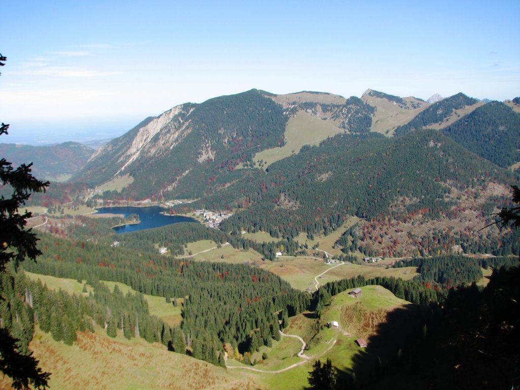
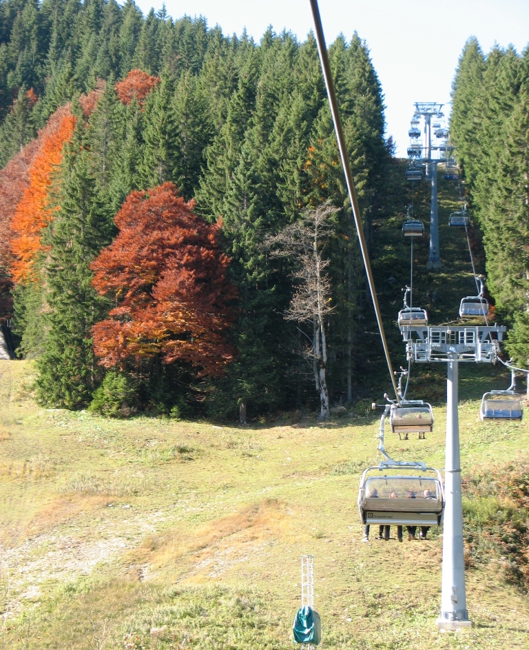
In the third photo, it's clear that we're in Autumn -- nice fall colors! You can see on the hiking map that the path criss-crosses the ski lift a couple of times (from the Roßkopf, go down and then left). You can see a lot of people on the lift, heading up to the Jagahütt'n. I didn't get a picture there, but it's a pleasant view for lunch. The colors of the leaves aren't quite as dramatic and beautiful as where I grew up (Western New York State) but they are nice!
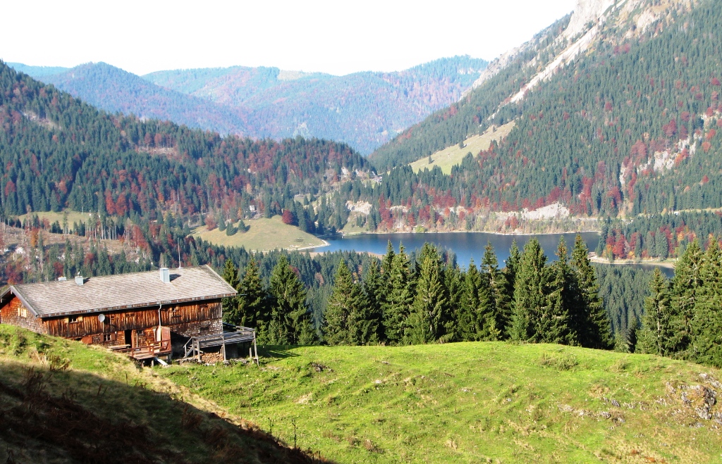
In the final photo, I was just about back down to lake-level and this house came out of nowhere. They're lucky to have this view! Overall this area feels smaller and quieter than most Alpine towns that lure outdoorsmen (Wikipedia German says there are only 200 inhabitants). And although the trails around Spitzingsee aren't the most challenging and might not appeal to thrill-seekers, they're even closer than the hiking options in Austria and are a great Munich day hike.
 Herr J ... Post a Comment